TOD MASTER PLAN DESCRIPTION
The Warm Springs Transit Village is part of the South Fremont Innovation District Community Plan adopted by the city in 2014. The Warm Springs Transit Village TOD master plan was developed with Toll Brothers to create a vibrant walkable residential mixed-use community […]
DESCRIPTION
The Lotus Boulevard Project is a design for a 7,500 unit township outside of Pune, India. The project is strategically located along the Old Pune Mumbai highway and adjacent to a future commuter rail station.
VISION
The design of the new township is focused on a grand […]
description
The Pleasanton TOD Standards and Guidelines, put together with TransACT for the City of Pleasanton and BART, creates overlay zones for three parcels in the Hacienda Business Park PUD and the BART parcel to allow for the incremental development of a TOD village around the […]
DESCRIPTION
The Denver Federal Center TOD is a phased Transit Oriented Development of 51 acres surrounding the Federal Center Light Rail Station, multi modal regional bus facility, and is adjacent to a major hospital and Federal Government employment center. The program calls for a 3 phase […]
description
The Upper Kirby District is located in the heart of Houston. Between the Galleria area and downtown, Upper Kirby District is immediately adjacent to Greenway Plaza, River Oaks, West University, and Montrose. The Livable Centers Study for the Upper Kirby study area builds upon and […]
DESCRIPTION
The Northside neighborhood, north of Houston’s downtown and connected through Main Street and the future San Jacinto Street, is easily accessible from I-45 and I-10, but cut off from downtown vacant industrial land. The study seeks to build off of previous planning efforts including the […]
description
Aiea-Pearl City Neighborhood TOD Plan is the third in a series of community-driven planning efforts in Honolulu for future station areas along the new elevated fixed guideway mass transit system. This TOD Plan consists of three station areas; Leeward Community College, Pearl Highlands and Pearlridge […]
description
The East Kapolei Neighborhood TOD Plan presents a unique opportunity to create a sustainable, responsible and integrated community for Oahu. Located along the proposed transit line that will connect downtown Honolulu with the East Kapolei region, Ho’opili, UHWO and East Kapolei Stations are each envisioned […]
DESCRIPTION
Waipahu Neighborhood TOD is two community plans for the siting and future urban redevelopment adjacent to the planned elevated fixed guideway transit system for the island of Oahu. This culturally diverse neighborhood is an historical plantation center. Waipahu is located just north of Pearl Harbor […]
description
The Ferry/Gateway District Plan for the City of Bainbridge Island, Washington focuses on a 10 acre site adjacent to a high capacity car ferry terminal, 40 minutes from downtown Seattle. VMWP is coordinating with the community, property owners and Washington State Ferries to create a […]
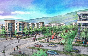 Warm Springs Transit Village TOD Master Plan
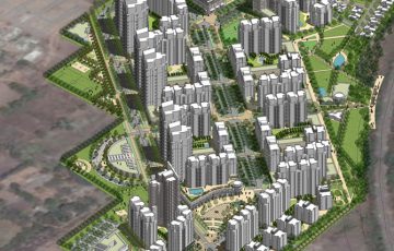 The Boulevard
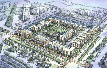 Pleasanton BART Transit Village
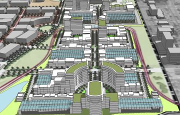 Federal Center TOD
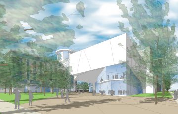 Upper Kirby Livable Centers Study
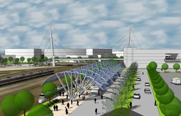 Northside Livable Centers Study
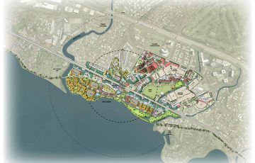 Aiea-Pearl City Neighborhood TOD
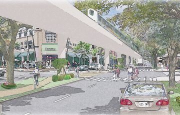 East Kapolei Neighborhood TOD Plan
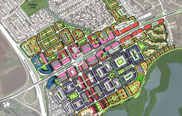 Waipahu Neighborhood TOD
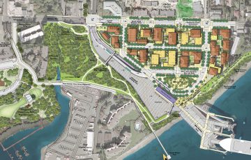 Bainbridge Ferry/ Gateway District Plan