description
The Upper Kirby District is located in the heart of Houston. Between the Galleria area and downtown, Upper Kirby District is immediately adjacent to Greenway Plaza, River Oaks, West University, and Montrose. The Livable Centers Study for the Upper Kirby study area builds upon and […]
DESCRIPTION
The Northside neighborhood, north of Houston’s downtown and connected through Main Street and the future San Jacinto Street, is easily accessible from I-45 and I-10, but cut off from downtown vacant industrial land. The study seeks to build off of previous planning efforts including the […]
description
Aiea-Pearl City Neighborhood TOD Plan is the third in a series of community-driven planning efforts in Honolulu for future station areas along the new elevated fixed guideway mass transit system. This TOD Plan consists of three station areas; Leeward Community College, Pearl Highlands and Pearlridge […]
description
VMWP is creating a framework or strategy plan for the City of South San Francisco that maps existing and potential opportunity sites, streetscape development projects, and public realm improvements throughout the Downtown district. This framework plan will create a blueprint for the City to follow […]
description
The East Kapolei Neighborhood TOD Plan presents a unique opportunity to create a sustainable, responsible and integrated community for Oahu. Located along the proposed transit line that will connect downtown Honolulu with the East Kapolei region, Ho’opili, UHWO and East Kapolei Stations are each envisioned […]
DESCRIPTION
The Santa Clara Fairgrounds project was a joint venture developer proposal to redevelop the approximately 150 acre Santa Clara County Fairgrounds property into a walkable mixed-use community. The plan focused around a diverse open space and stormwater management network that connects the residential areas to […]
DESCRIPTION
The Westminster mall sits at the crossroads of US 36, Sheridan Street and 88th Avenue, adjacent to a planned Regional Transportation District multimodal commuter rail stop. The plan for this new urban neighborhood is organized by a traditional pedestrian-oriented street grid surrounding a central Town […]
DESCRIPTION
The Sunnydale community, originally built as a visionary housing solution for wartime ship builders, is now a dilapidated assembly of disconnected buildings. Its leftover spaces are difficult to police and difficult to access. The new Sunnydale will be redeveloped incrementally to create a network of […]
DESCRIPTION
Waipahu Neighborhood TOD is two community plans for the siting and future urban redevelopment adjacent to the planned elevated fixed guideway transit system for the island of Oahu. This culturally diverse neighborhood is an historical plantation center. Waipahu is located just north of Pearl Harbor […]
DESCRIPTION
The Milpitas Square project is a phased redevelopment of a 162K square feet strip retail center, one of the largest Asian shopping centers on the West coast, into a dynamic mixed-use neighborhood and shopping district. The goal of the project is to take a non-place […]
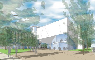 Upper Kirby Livable Centers Study
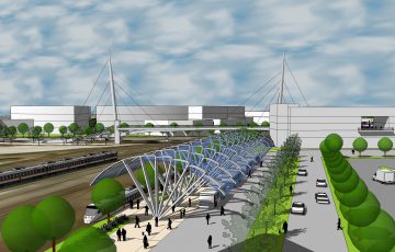 Northside Livable Centers Study
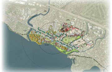 Aiea-Pearl City Neighborhood TOD
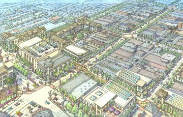 SSF Downtown Strategy Plan
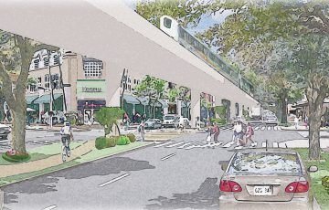 East Kapolei Neighborhood TOD Plan
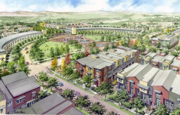 Santa Clara Fairgrounds
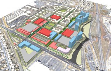 Westminster Mall
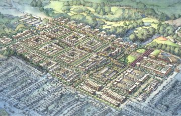 Sunnydale Hope SF Master Plan
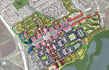 Waipahu Neighborhood TOD
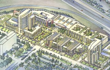 Milpitas Square